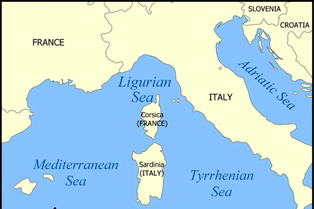
Croatia is set to feel the effects of a Genoa cyclone from Thursday evening, which will influence the weather through the end of the upcoming weekend. The forecast was released on Wednesday, August 19, 2026, by meteorologist Bojan Lipovšćak, and is reported by Z NET and N1 Hrvatska.
According to his forecast, southerly winds and cloudiness are expected in the northern and central Adriatic, all the way to Cape Horn, i.e., Punta Planka. Local thunderstorms may bring heavier rainfall in some areas.
Southern Dalmatia Remains Under High Pressure
Unlike the northern and central Adriatic, southern Dalmatia will be under the influence of a high-pressure system. Warm and hot weather with plenty of sunshine is expected there, with only a slight increase in cloudiness on Friday.
The sea is warm, between 25 and 27°C, and with clear skies, UV radiation is extremely strong. Daily air temperatures will reach highs between 30 and 35°C.
What Thursday and Friday Bring
Thursday will be mostly sunny. In the evening and night hours of Friday, in the northern Adriatic and Gorski Kotar, cloudiness from the west is expected, with occasional thunderstorms. During the afternoon and evening, cloudiness will spread from the west toward the northwestern parts of the interior, and near the Slovenian border, local unstable conditions are possible.
On Friday, due to the influence of the cyclone from Genoa, the western parts of the interior and the Adriatic will see variable to mostly cloudy conditions with occasional rain showers. On the central and southern Adriatic, local storms with heavy rain and strong wind gusts are possible, with strong and gale-force southerly winds.
Temperatures and Wind
Morning air temperatures in the mountainous regions of the interior will be around 10°C, and in basins and river valleys, morning fog is possible in places. At night, temperatures in the interior will be around 18°C, while the Adriatic will be warm, with temperatures around 22°C.
As the cyclone over the Gulf of Genoa approaches and strengthens, the wind will pick up, so strong southwest winds will blow in the mountainous areas of the interior, and on the Adriatic, southerly and sirocco winds will strengthen. Only from Saturday will air temperatures drop by one to two degrees.