New Weather Deterioration: Cyclone Brings Rain and Strong Sirocco
After a stable Wednesday, from Thursday evening through the weekend, Croatia will be affected by a Genoa cyclone bringing rain, strong sirocco winds, and local thunderstorms.
After a stable Wednesday, from Thursday evening through the weekend, Croatia will be affected by a Genoa cyclone bringing rain, strong sirocco winds, and local thunderstorms.
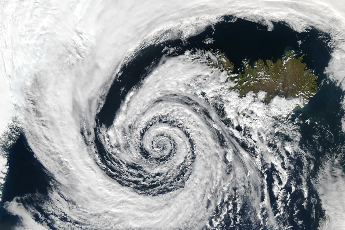
Over Europe, the synoptic picture shows deep cyclonic activity in Scandinavia and a high-pressure area extending over the Mediterranean. The Adriatic and the mainland remain under the influence of an anticyclone, which ensures mostly sunny conditions, but this will soon change. According to meteorologist Bojan Lipovšćak for N1, during the rest of the week, the jet stream will cross the Alps and form a cyclonic system in the Gulf of Genoa, which will affect Croatian weather from Thursday evening through the weekend.
Today, the interior will see partly cloudy skies, while the Adriatic will be mostly sunny. In the afternoon, significant cloud development is possible in mountainous areas, Istria, and Kvarner, with the possibility of isolated showers in Gorski Kotar. Winds will be light to moderate from the southwest and south, while on the Adriatic, the bura and tramontana will strengthen towards the end of the day.
Daily maximum temperatures will range between 29 and 33°C. Sea temperatures are high, between 25 and 27°C, and the UV index, due to clear skies, will reach very high values.
Thursday brings mostly sunny weather, but in the evening and during the night into Friday, cloudiness will arrive from the west. The northern Adriatic and Gorski Kotar will be affected first, with the possibility of thunderstorms. Then, cloudiness will spread to the northwestern parts of the interior, with possible local instability near the Slovenian border.
Winds will strengthen due to the approaching cyclone. In the mountains, a strong southwest wind will blow, while on the Adriatic, the sirocco and tramontana will strengthen. Morning temperatures in the highlands will be around 10°C, in the lowlands around 18°C, and the Adriatic will experience a warm night with temperatures around 22°C. Daily maximum temperatures will range from 30 to 35°C.
On Friday, the influence of the Genoa cyclone will be felt across most of the country. In the western parts of the interior and on the Adriatic, the weather will be changeable to mostly cloudy with occasional rain. For the northern and central Adriatic, up to Punta Planka, sirocco winds and cloudiness are forecast, with local thunderstorms and locally heavy precipitation.
In the central and southern Adriatic, local thunderstorms with heavy downpours are possible, accompanied by strong and gale-force sirocco winds. Southern Dalmatia, however, will remain under the influence of the anticyclone for most of the week, with warm and sunny weather, and only a slight increase in cloudiness on Friday. Air temperatures will drop by one to two degrees only from Saturday.