Saharan Sand Reaches Croatia with Temperatures Up to 37°C
Temperatures will reach up to 37°C, and due to Saharan sand, the sky may take on a yellowish hue early in the week. Yellow and red warnings have been issued for several regions.
Temperatures will reach up to 37°C, and due to Saharan sand, the sky may take on a yellowish hue early in the week. Yellow and red warnings have been issued for several regions.
After a brief respite, Croatia is bracing for an intense heatwave that will mark the start of the upcoming week. Alongside temperatures ranging from 32 to 37°C, a cloud of Saharan sand will affect parts of the country, bringing a characteristic yellowish tint to the sky.
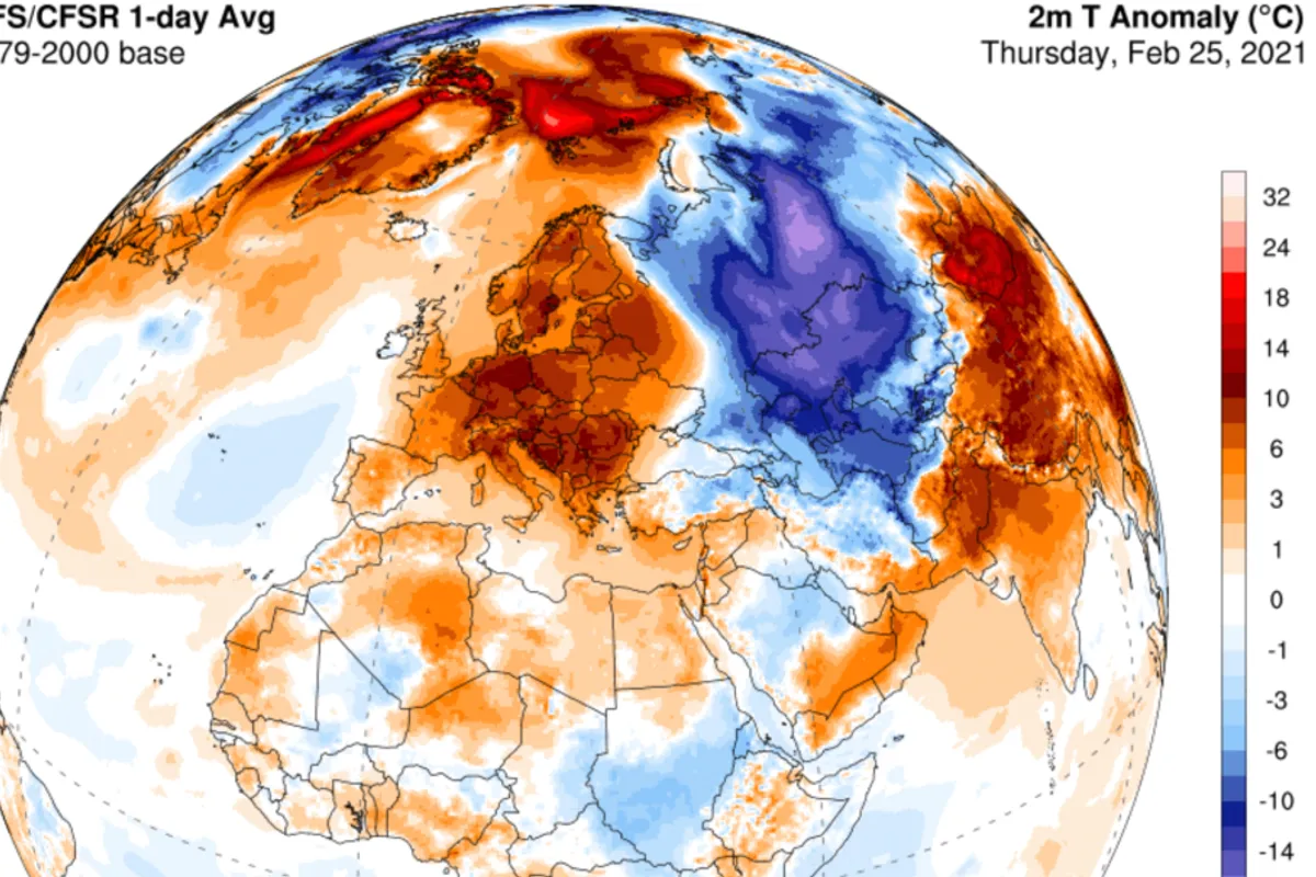
The weather picture over Europe is currently shaped by a high-pressure system accompanied by an influx of very warm air of African origin. At the same time, south of Iceland, over the Atlantic, a deep cyclone is situated. On its leading edge, strong southeasterly winds toward Western Europe are bringing warm and dry air from North Africa.
Winds over the Sahara have lifted large amounts of sand and dust into the air, which are now being transported toward the European continent by upper-level currents. The Saharan sand will first affect Spain, Portugal, and France, then move north of the Alps.
Some of the Saharan dust particles are expected to reach Croatia as well, so the sky over the western parts of the country may take on a yellowish hue during Tuesday and Wednesday (August 11 and 12, 2026). This phenomenon results from the scattering of sunlight on sand particles in the atmosphere.
The heatwave continues in full force. According to forecasts, today is expected to be mostly sunny with a further rise in temperatures, especially in the interior. Temperatures inland will range between 31 and 34°C during the day, while along the Adriatic they will be between 33 and 36°C.
For tomorrow (August 10, 2026), a yellow Meteoalarm warning is in effect for Osijek and Slavonia from 9 a.m. to 9 p.m. "Hot day. Maximum temperature > 35°C," the warning states. In Osijek, around 35°C is expected. Tomorrow's forecast reads: "Sunny, hot, and very hot. Wind mostly light. Daily highs mostly between 32 and 37°C."
Even more pronounced heat is expected during the upcoming week. A red warning has been issued for the areas of Rijeka, Split, and Dubrovnik due to the heat, while the rest of Croatia will be under a yellow alert.
In the upper layers of the atmosphere, there will be some more unstable air, so a stronger development of cumulus clouds is possible during the afternoon. In the interior of Dalmatia and near the mountains along the border with Bosnia and Herzegovina, local showers with thunderstorms and occasionally strong winds are possible.
During the night and morning, a moderate bura wind will blow on the Adriatic, which, due to the foehn effect, will further increase air temperatures. After the bura weakens in the afternoon, the maestral will set in. Sea temperatures range between 25 and 27°C, and the UV index will be high to very high. A yellow warning has also been issued for the coast from Kvarner to southern Dalmatia due to strong to gale-force bura winds.
According to current forecasts, stable and very warm weather could persist for another ten days. In the northwestern interior and the northern Adriatic, there will be a slightly higher chance of occasional afternoon showers.
After this heatwave, temperatures will drop, but will still be summery and hot, just not extremely high. Rain is not expected for several more days.
The situation over the Pacific is also interesting, with three powerful tropical systems having developed: Dolphin, Chan Hom, and Kujira. The development of typhoons is strengthening El Niño, which shifts warm Pacific waters toward the east and center of the ocean, giving them more energy.
For now, the stronger El Niño is mainly felt in the Pacific, with its greater impact on European weather expected only in late autumn and early winter.